 Onondaga Lake Watershed -- A Geographic Information System Project Phase I -- Needs Assessment and Spatial Data Framework
by Douglas A. Freehafer and Oliver Pierson
U.S. GEOLOGICAL SURVEY
Open-File Report 2004-1259
ABSTRACT
In the fall of 2002, the Onondaga Lake Partnership (OLP) formed
a Geographic Information System (GIS) Planning Committee
to begin the process of developing a comprehensive watershed
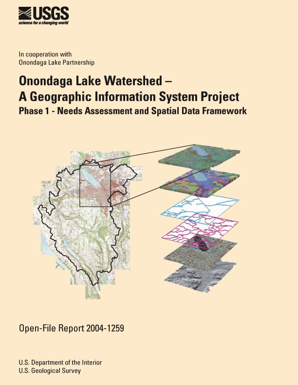
geographic information system for Onondaga Lake. The goal
of the Onondaga Lake Partnership geographic information
system is to integrate the various types of spatial data
used for scientific investigations, resource management, and
planning and design of improvement projects in the Onondaga
Lake Watershed. A needs-assessment survey was conducted
and a spatial data framework developed to support the
Onondaga Lake Partnership use of geographic information
system technology. The design focused on the collection,
management, and distribution of spatial data, maps, and
internet mapping applications. A geographic information
system library of over 100 spatial datasets and metadata
links was assembled on the basis of the results of the needs
assessment survey. Implementation options were presented,
and the Geographic Information System Planning Committee
offered recommendations for the management and distribution
of spatial data belonging to Onondaga Lake Partnership
members. The Onondaga Lake Partnership now has a
strong foundation for building a comprehensive geographic
information system for the Onondaga Lake watershed. The
successful implementation of a geographic information system
depends on the Onondaga Lake Partnerships determination
of: (1) the design and plan for a geographic information
system, including the applications and spatial data that
will be provided and to whom, (2) the level of geographic
information system technology to be utilized and funded, and
(3) the institutional issues of operation and maintenance of
the system.
Citation: Freehafer, Douglas A. and Pierson, Oliver, 2004, Onondaga Lake Watershed -- A Geographic Information
System Project Phase I -- Needs Assessment and Spatial Data Framework: U.S. Geological Survey Open-File Report 2004-1259, 79 p.; online only.
 [Full Report, Acrobat PDF
(3.2M)]
[Full Report, Acrobat PDF
(3.2M)]
[an error occurred while processing this directive]
|