The U.S. Geological Survey (USGS) is one of over a dozen Federal agencies participating in the Urban Waters Federal Partnership (UWFP)a Federal program aimed at revitalizing urban waterways for the good of underserved communities and the environment. This initiative is realized through support of local projects, participating in community outreach events, and providing data necessary to make important decisions about improving the local waterways through innovative infrastructure and parkland preservation. One such innovative project is underway at Pier 5, a former shipping dock along the Harlem River in Bronx, N.Y. This abandoned 5-acre lot is adjacent to the newly renovated Mill Pond Park and has been acquired by the N.Y. City Parks Department. The hope of the Parks Department and community groups that Pier 5 will soon be incorporated into Mill Pond Park to create more continuous greenways along the river, which itself is in need of attention due to its chronically poor water quality.
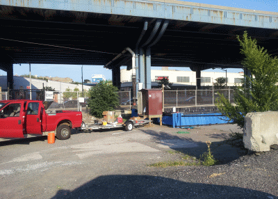
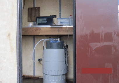
In an effort to revitalize the Harlem River--one of the original seven waterways chosen by the White House for the UWFP in 2011--community workgroups: Bronx Council for Environmental Quality (BCEQ) and Harlem River Working Group (HRWG) have secured Federal grants to create a new riverside park that will divert highway runoff into a system of engineered planter boxes (called Pop-Up Wetlands) to retain and treat the polluted water before reaching the river. The effort is currently in its pilot stage, and in order to quantify the contribution that the engineered park has on the quality of water discharged to the Harlem River, baseline measurements of the stormwater runoff and soil capacity must be established before full construction of the park begins. Analyses
|


| Stormwater runoff, storm drain runoff, and Harlem River water samples | Analytes |
|---|---|
| Metals (unfiltered) | Arsenic, Barium, Beryllium, Cadmium, Cerium, Chromium, Cobalt, Copper, Iron, Lead, Manganese, Mercury, Molybdenum, Nickel, Palladium, Platinum, Rubidium, Selenium, Silver, Vanadium, Zinc |
| Major Inorganics (filtered) | Bromide, Calcium, Chloride, Fluoride, Magnesium, Sodium, Silica, Sulfate |
| Total Phosphorus (unfiltered) | Phosphorus |
| Total Nitrogen (unfiltered) | Nitrogen |
| Total Organic Carbon (unfiltered) | Carbon |
| Total Petroleum Hydrocarbon (unfiltered) | Fuel, Oil, and Grease |
| Basic parameters (unfiltered) | pH and specific conductance (assessed in field and lab), Total dissolved solids |
| Samples of engineered soil | Analytes |
|---|---|
| Metals | Arsenic, Barium, Beryllium, Cadmium, Cerium, Chromium, Cobalt, Copper, Iron, Lead, Manganese, Mercury, Molybdenum, Nickel, Palladium, Platinum, Rubidium, Selenium, Silver, Vanadium, Zinc |
| Major Inorganics | Bromide, Calcium, Chloride, Fluoride, Magnesium, Sodium, Silica, Sulfate |
Working with BCEQ to better understand the current quality of the stormwater runoff and how much pollutant loading will be reduced are goals consistent with the USGS mission to advance the general knowledge of waterbodies and provide technical expertise and unbiased information in an effort to evaluate nonpoint source pollution into the Harlem River and greater N.Y./N.J. Harbor Estuary. This quantitative information could also be used by State and local stakeholders towards development of a Total Maximum Daily Load for contaminants to the Estuary. The BCEQ has expressed interest in expanding this data collection effort beyond Pier 5 as more parks and green spaces are developed. The USGS remains a committed partner in the UWI by supplying information that will ultimately enhance the quality of life for residents of New York City as more redevelopment projects come to fruition. For more information on the USGS Urban Waters Initiative, visit: https://www.sciencebase.gov/catalog/item/560e88e5e4b0ba4884c5eaf2
-
Related Links
-
References
For additional information contact:
(1) Director
U.S. Geological Survey
Troy Program Office
New York Water Science Center
425 Jordan Road
Troy, NY 12180
(518)285-5600
http://ny.water.usgs.gov
Part or all of this report is presented in Portable Document Format (PDF); the latest version of Adobe Reader or similar software is required to view it. Download the latest version of Adobe Reader, free of charge.