New York State Department of Environmental Conservation
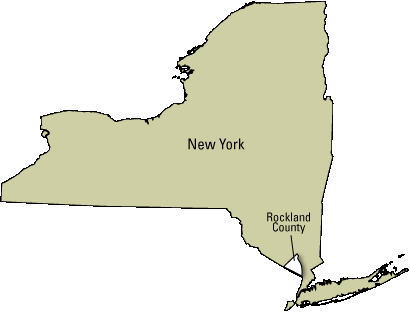
Rockland County Water-Resource Assessment
Project Summary:
Summary of Results from the USGS Water-Resource Investigation of Rockland County, New York, 2005-2007
In 2004, concerns over the sustainability of water resources in Rockland County, New York prompted an assessment of the hydrogeology of Rockland County by the U.S. Geological Survey. The investigation included a review of all resources, but focused on the Newark Basin aquifer, a fractured, sedimentary bedrock aquifer over which nearly 300,000 people reside. About 12.7 billion gallons of water were used in Rockland County in 2005, about 35 percent of which was withdrawn from the bedrock aquifer. A regional conceptual model of the aquifer framework was developed and integrated with other hydrogeologic data to define the regional groundwater flow system. Groundwater flow within the aquifer is largely constrained by the strike of the dipping conglomerate, sandstone, and siltstone bedrock units, as the most productive water-bearing fractures are subparallel to the bedding of these units.
Review of pumpage and water-level data from the bedrock aquifer back to 1989 suggests that there has not been a continuous downward trend in groundwater levels across the aquifer. Groundwater levels have locally declined in response to new stresses from production wells, especially when they have been used continuously. The greatest concern regarding sustainability of groundwater resources is the aquifer response to the annual increase in pumpage from May through October (a 25 percent average increase in 2005). Streams are also affected by seasonal groundwater pumpage; nearly all streams in the productive west-central area of the aquifer ceased to flow during the dry late summer of 2005. Annual recharge estimates from 1961 streamflow data range from 15 to 25 inches; this variation arises from differences in precipitation, overburden thickness, and percent of impervious cover across the aquifer. Sustainability of water resources in Rockland County is largely dependent on: (1) the ability to adjust water-use during drought periods and during summer peak-demand periods, and (2) to avoid loss of supply from groundwater contamination.

Publications:
Heisig, P.M., 2010, Water resources of Rockland County, New York, 2005–07, with emphasis on the Newark basin bedrock aquifer: U.S. Geological Survey Scientific Investigations Report 2010–5245, 130 p., at http://pubs.usgs.gov/sir/2010/5245/.
Yager, R.M. and Ratcliffe, N.M., 2010, Hydrogeology and simulation of groundwater flow in fractured rock in the Newark basin, Rockland County, New York: U.S. Geological Survey Scientific Investigations Report 2010–5250, 137 p., at http://pubs.usgs.gov/sir/2010/5250/.
Author contact information:
| Paul Heisig USGS NYWSC Troy, NY tel. (518) 285-5648 email: pmheisig@usgs.gov |
Dick Yager USGS NYWSC Ithaca, NY tel. (607) 266-0217 x3004 email: ryager@usgs.gov |
Abstract of study findings presented at the "State of the Hudson River Watershed" conference, September 28, 2009 at Hyde Park, NY.
| Video of presentation at Lamont-Doherty - April 25, 2010 |
 |
2 page Summary of Selected Study Findings |
 |
PowerPoint of Selected Study Findings |
Previous USGS studies of Rockland County water resources:
Perlmutter, N.M., 1959, Geology and ground-water resources of Rockland County, New York: New York State Water Power and Control Commission Bulletin GW-42, 133 p. "LIZARDTECH", at http://onlinepubs.er.usgs.gov/djvu/Misc/gw_bull_42.djvu.
Moore, R.B., Cadwell, D.H., Stelz, W.G., and Belli, J.L., 1982, Geohydrology of the valley-fill aquifer in the Ramapo and Mahwah Rivers area, Rockland County, New York: U.S. Geological Survey Open-File Report 82-114, 6 sheets, scale 1:24,000. "LIZARDTECH", at http://pubs.er.usgs.gov/publication/ofr82114.
USGS Reports on groundwater resources of The Nation, and nearby Northern Atlantic Coastal Plain aquifer system:
Reilly, T.E., Dennehy, K.F., Alley, W.M., and Cunningham, W.L., 2008, Ground-Water Availability in the United States: U.S. Geological Survey Circular 1323, 70 p., also available online at http://pubs.usgs.gov/circ/1323/.
Masterson, J.P., Pope, J.P., Monti, Jack, Jr., and Nardi, M.R., 2011, Assessing groundwater availability in the Northern Atlantic Coastal Plain aquifer system: U.S. Geological Survey Fact Sheet 2011–3019, 4 p., at http://pubs.usgs.gov/fs/2011/3019/.
Maps (Poster-Size):
 |
Poster-size PDFs (georeferenced 24"x32") of figures 7, 9, 11, 16–18, 20, 29, 30–32, 37–40, and 46–47 in the Heisig (2010) report.
 |
Note: In Acrobat Reader, activate "Layers" along left edge, then click eye to turn on/off map features. (View -> Show/Hide -> Navigation Panes -> Layers)
Interactive Data Applications:
![]() Hydrologic data collection by the USGS in Rockland County and Northern New Jersey
(Real time -- data downloads every 1 to 4 hrs)
Hydrologic data collection by the USGS in Rockland County and Northern New Jersey
(Real time -- data downloads every 1 to 4 hrs)
Impervious Runoff Video:
 |
VIDEO of storm water runoff during summer thunderstorm showing effects of impervious surfaces. |
Selected Illustrations:
 |
") |
 |
 |
 Affects the Updip Areal Extent of Production Well Capture Zones") |
 |
 |
 |
 in the Mahwah River") |
Related Links:
- Rockland County
- Rockland County Department of Health -- Water Supply
- Rockland County Department of Health -- Peak Water Supply available for new development
- New York State DEC
- New Jersey DEP
- United Water New York
- USEPA
- LaMont-Doherty Earth Observatory -- Water Resources in Rockland County
- U.S. Geological Survey --
New York Water Science Center
New Jersey Water Science Center